Millstream again and again
updated 6th May 2024
November 2022.
Millstream Falls is the widest waterfall in Australia but I rarely take a photo of it that shows the full width. I am always drawn to sections of the falls rather than the grand picture.
February 2022
That said, here is a photo of the entire falls and to give you some idea of scale there are two people standing to the left at the top of the waterfall in the photo above.
November 2020
On a recent visit to the falls and the surrounding area it occurred to me that I have visited there more times than I can count and it is always different. When the water flow allows me to view the rock face I think the waterfall is at its prettiest.
The rock formations are the highlight here
The top of the waterfall, May 2021.
As you could see in the first photo of this post from the two women in it you can make your way to the top of the waterfall. The area above the falls has some very pretty rock formations. If you venture to the top watch the level of water flow. Once the rocks are wet they are very slippery…. beware of rain arriving.


If the water flow is not too strong, early mornings and the rock face is spectacular as the sun hits it. For me it is all about that rock face so when the water flows too heavily I find the falls just a mush of white.
January 2020.
Some of the most spectacular rock formations are at the base of the falls and as a bonus they are almost always wet….which makes them look even better.
The bottom of the Falls
February 2022.
It is a slice of heaven along the river below the falls. I spend most of my time in this area when I visit.
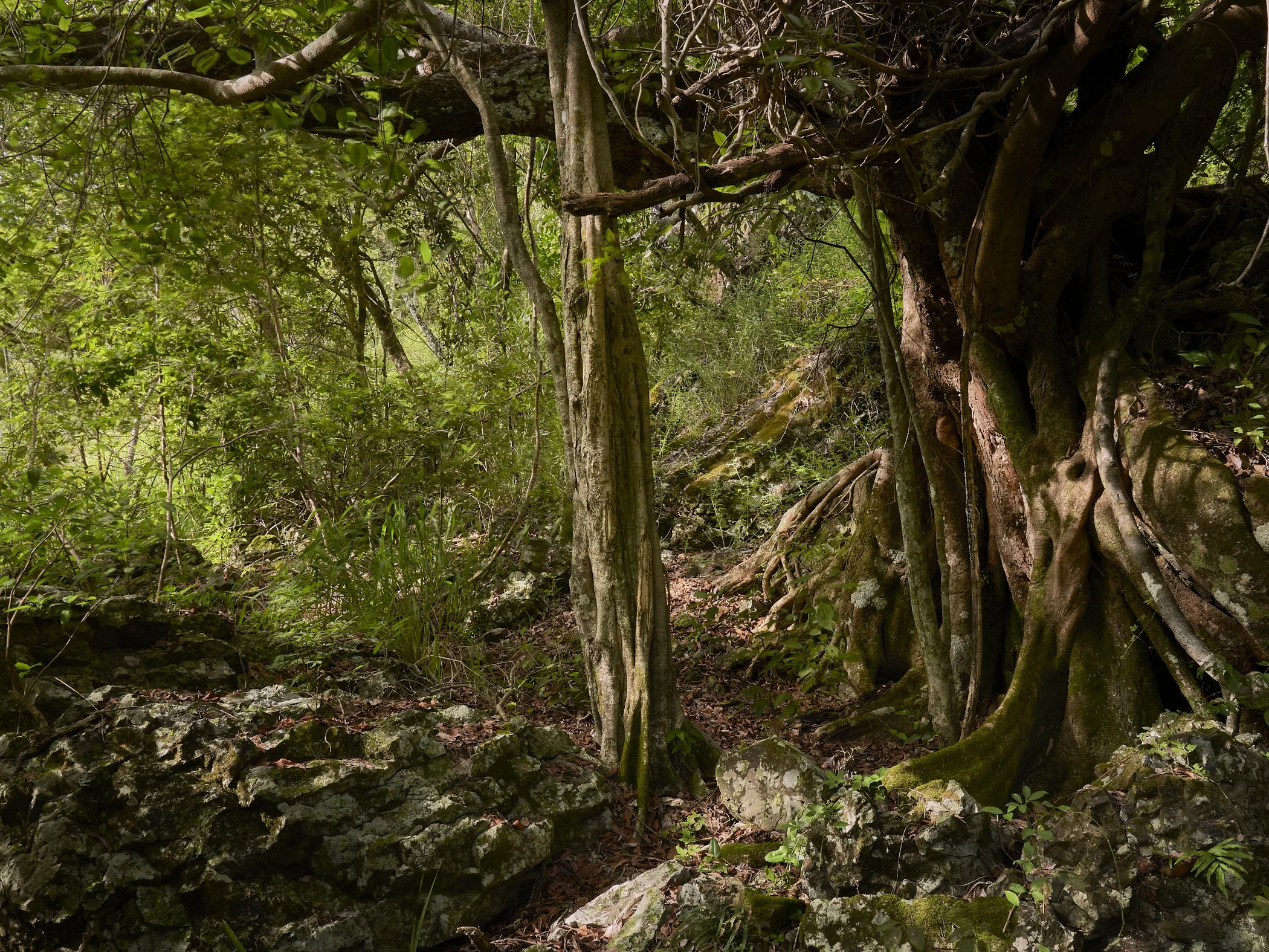


The rainforest around the base is usually pretty wet from water spray in the air or from the regular rain you get in the Ravenshoe area. When the sun does come out the canopy provides some welcome shade.
A hidden gem
February 2020.
Located along the river is this beautiful little waterfall. Truly a slice of heaven and it has a very cool feature to it.
February 2020
You can walk right under or stand in it. I would not recommend the latter if the water flow is strong. I find that tree on the other side quite fascinating as well.
December 2020.
In February 2020 I shared this spot with my son Alistar and he took the chance to cool off under the waterfall. Even with this level of flow the water was pounding him.
February 2020
There is a large swimming hole at the base. Just be careful as it is usually full of deadfall. I would not be diving in here.
It is not all sunshine and rainbows at Millstream
May 2020
What you cannot see in the photo above is a pest that is invading the waterways on the Tablelands. After that photo was taken in May 2020 we headed into a dry spell that slowed down the flow of water and highlighted the invasion of a weed.
December 2020.
Before the rain came late 2020/early 2021 the base of the falls was almost entirely covered with what I believe is a pest that grows on the water surface. Tarzali Lakes is sadly also very badly effected by this weed. One of my favourite photos is of a Platypus breaking through this weed at Tarzali.


Much was washed away by the heavier water flows of late 2022 and 2023 but the weed still remains as the above photos taken in August 2023 show.
December 2020.
It might have been unrelated but whilst that plant covered much of the water I spotted quite a few turtles like the one above. My wife refers to this one as Turtlekhamun.
The base of the falls, February 2024.
Following cyclone Jasper much of the weed has once again been washed away. The debris lodged about 15-20 feet up that tree indicates how high the water got in the floods that followed Jasper.
These are not weeds…….I think.
July 2023.


There are some quite pretty flowers that you will see around the waterfall during the year. If they are natives or not I have no idea.
December 2020.
Vegetation in general seems to be able to grow in almost any location there. I can understand how a seed got there from a perched bird but the next photo…..how?
December 2020
Just amazes me how a seed can find its way there and then flourish enough to grow.
The military connection.
Information monument about the encampment there during WWII.
During WWII Millstream Falls was home to a military encampment. There is a short walk from the falls carpark that takes you through some of the old campsite.
Remains of urinals at the encampment.
There are still a few remnants of the old structures but not many. The most interesting spot I found on the walk was the parade area.
Signage along the walk/
I could readily imagine the raising of the flag there from the illustration on the signage. The walk is less than 500 metres and well worth the time.
What most see at Millstream
Visiting with my wife, May 2021.
A very longtime ago there was a path to the base of the falls. National Parks have since demolished that. For most people they will enjoy the falls from the lookout. To get there just follow the short paved path from the carpark.
The photo many have taken form the lookout, January 2020.
From the lookout trees obscure part of the view to the falls. Images like the one above are what you will most likely achieve from the lookout.
View from the dirt track to the top of the falls, August 2023.
If you decide to take the walk down the dirt track from the lookout to the top of the falls there are a few spots from where you can get views of the falls like in the above photo. Be careful at the edge as it is a long way down and the water is not as deep as you would think…….if you do not hit a rock before you splash.
Drone crash, December 2022.
I have no idea how long this drone had been on that rock before I found it in December 2022 but drones seem to be a popular way to explore the base of the falls.
If you decide to attempt to make your way to the base on foot expect a steep descent, very high razor grass (at times over 6 feet), obscured rocks and logs and the odd snake. Long pants and shirt sleeves as well as good footwear strongly recommended.
Amenities and how to get there

Adjacent to the carpark at Millstream is a picnic shelter and toilet facilities. There is no barbecue facility and camping is not allowed. To get there head out of Ravenshoe towards Mt Garnet and a few kilometres out of town turn left at the signage to make your way about 1 kilometre down a dirt road to the carpark. Enjoy!